
1. The Nile River on an Ancient Egyptian Ma
The Nile River was the most important geographical feature of Ancient Egypt. Any map of Ancient Egypt must place the Nile at its center because Egyptian civilization developed primarily along its banks. The river provided water for agriculture, supported settlements, created transportation routes, and connected communities from southern Egypt to the Mediterranean coast.
The Nile flows generally from south to north, eventually reaching the Mediterranean Sea. This direction influenced the Egyptian geographical concepts of Upper Egypt and Lower Egypt. Upper Egypt referred to the southern Nile Valley, while Lower Egypt referred to the northern region, particularly the Nile Delta.
Ancient Egyptians depended heavily on the annual flooding of the Nile. The flood deposited fertile soil across agricultural land, allowing farmers to grow crops such as wheat, barley, vegetables, and flax. The agricultural wealth created by the river supported cities, temples, armies, and government institutions.
The Nile was also Egypt’s most important transportation route. Boats could carry grain, stone, timber, people, livestock, and other goods. Traveling by river was often easier than traveling across the desert.
Many important Egyptian cities were located directly along the Nile. These included ancient centers such as Elephantine, Thebes, Abydos, and Memphis. Temples and administrative centers were frequently positioned close to the river because of its importance for transportation and religious ceremonies.
The river also influenced Egyptian religion. The Nile was associated with fertility and renewal, while the annual flood was connected with divine forces and agricultural prosperity.
On an Ancient Egyptian map, the Nile therefore acts as the geographical backbone of the country. The river connects the major regions of Egypt and explains why settlements, agricultural fields, temples, and transportation routes developed along its course.
The importance of the Nile demonstrates how Ancient Egyptian geography was closely connected with agriculture, economy, religion, transportation, and political organization.
2. Upper Egypt and Lower Egypt
One of the most important geographical divisions shown on an Ancient Egyptian map is the distinction between Upper Egypt and Lower Egypt. These names can initially seem confusing because Upper Egypt is located in the south and Lower Egypt is in the north. The terms refer to the elevation and direction of the Nile rather than modern ideas of north and south.
Upper Egypt consisted mainly of the narrow Nile Valley south of the Delta. The river was surrounded by desert, creating a relatively narrow strip of fertile agricultural land. Important ancient cities in Upper Egypt included Thebes, Abydos, Dendera, Edfu, and Elephantine.
Thebes became one of the most important political and religious centers in Egyptian history. The city was located on the eastern bank of the Nile, while major temples and royal burial areas were located nearby on both sides of the river.
Lower Egypt consisted mainly of the northern Nile Valley and the broad Nile Delta. The Delta contained numerous branches of the river and extensive fertile land. It was an important agricultural and commercial region.
Memphis was located near the boundary between Upper and Lower Egypt and became a major political and religious center. Its location allowed rulers to control important routes connecting the Nile Valley and Delta.
The division between Upper and Lower Egypt was also important symbolically. Egyptian kings were traditionally described as rulers of the Two Lands. The unification of Upper and Lower Egypt became a fundamental part of Egyptian royal ideology.
The crowns of Egypt reflected this division. The white crown was associated with Upper Egypt, while the red crown represented Lower Egypt. The combined crown symbolized the united Egyptian kingdom.
The geography of the two regions influenced local economies and settlement patterns. Upper Egypt depended heavily on the narrow agricultural valley, while Lower Egypt benefited from the fertile Delta and access to Mediterranean trade.
Understanding Upper and Lower Egypt is essential when reading an Ancient Egyptian map because these regions shaped Egyptian political organization, culture, religion, agriculture, and history.
Together, they formed the unified kingdom that became one of the world’s most influential ancient civilizations.
3. The Nile Delta and Mediterranean Coast
The Nile Delta was one of the most fertile and strategically important regions of Ancient Egypt. Located in northern Egypt where the Nile spreads into multiple branches before reaching the Mediterranean Sea, the Delta played a major role in agriculture, trade, transportation, and international contact.
On an Ancient Egyptian map, the Delta appears very different from the narrow Nile Valley farther south. Instead of a single river surrounded by desert, the northern region contained numerous waterways, marshes, lakes, and fertile agricultural areas.
The rich soil of the Delta supported the cultivation of wheat, barley, vegetables, fruits, and other crops. Agricultural production helped feed Egypt’s large population and supported the wealth of temples, estates, and government institutions.
The Delta also provided access to the Mediterranean Sea. This made northern Egypt an important gateway for trade and diplomatic contact with the eastern Mediterranean, the Levant, Cyprus, and other regions.
Ancient cities developed throughout the Delta. Sais, Bubastis, Mendes, Tanis, and Naucratis became important centers at different periods. Their locations allowed them to participate in regional agriculture, commerce, religion, and political activity.
The Delta was also vulnerable to foreign invasion because of its proximity to the Mediterranean and northeastern land routes. Egyptian rulers had to protect the region from potential attacks and control access into the country.
The waterways of the Delta were valuable for transportation. Boats could move agricultural products and other goods between settlements and toward the Mediterranean coast.
The Delta also had religious importance. Many Egyptian gods and goddesses were worshipped in cities throughout the region, and temples became centers of local identity.
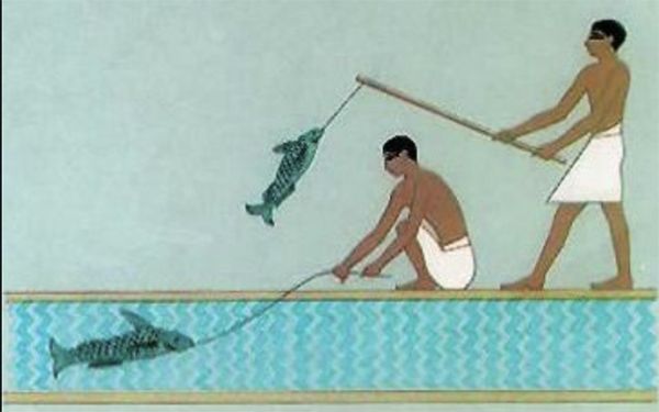
Its natural environment supported a variety of wildlife, including birds, fish, and other animals that appeared frequently in Egyptian art.
The Nile Delta on an Ancient Egyptian map therefore represents more than an agricultural region. It was a major economic center, transportation network, religious landscape, and gateway between Egypt and the wider Mediterranean world.
Its fertile land and strategic position helped make Lower Egypt an essential part of the ancient Egyptian kingdom.